In this series we will be asking our panel of experts across the geospatial, telecom and utility industries questions about the key issues impacting our world today. With unpredictable weather events increasing, we have asked participants how organizations can best use geospatial network data to support disaster response.
“Extreme weather events are continuing to rise globally, and we’ve seen the impact they can have on critical utility and telecom infrastructure. From the Texas Groundhog day blizzard in the US, to Storm Eunice in the UK, network operators are contending with forces that can be brutal and unpredictable.
With this in mind, how can companies best use geospatial network data to support disaster response activities while creating strategies for greater network resilience?”
 “At NetPMD we believe prevention is better than cure. Previously we considered 100-year flood events when designing, but these have already proved insufficient, and now we use the latest 500-year flood mapping to identify future risks and mitigate them. Similarly, we are now considering the impact of solar gain and increased ambient temperatures on fiber equipment cabinets and shelters and their design and orientation to ensure they can cope with projected temperature rises. Making these sorts of changes at the design stage has little impact on costs but will make the networks considerably more likely to keep working reliably through extreme weather events.
Of course, sometimes extreme weather will still overwhelm good design. If that does happen, then having accurate geospatial network records means you can plan your response to help ensure the swiftest possible service restoration. It can help tell you which critical customers are likely down, what assets have been impacted, and even inform where you should prioritize your work crews for maximum impact. Furthermore, it allows you to ensure you have suitable spares onboard ahead of any truck-roll to the repair. This insight will become more and more important as the frequency and scale of weather events increases.”
Find out more about NetPMD.
 “Geospatial network information is critical to both storm preparation and response. A good example is vegetation management. To protect the overhead Transmission and Distribution (T&D) grid, it is imperative to remove vegetation that presents a danger to electricity supply and/or allows wires to make contact with surrounding foliage and potentially ignite it. Geospatial network models, along with imagery and point data can identify high risk areas for immediate remediation by the utility. A T&D grid “digital twin” is also a powerful tool to plan, estimate, and design network hardening projects such as underground conversion, line design, and structure strengthening.
In both cases, the financial benefits can be quantified in advance to justify expenditures to regulators. For storm response, there are several ways to use the geospatial network model to mitigate outage duration & speed recovery. Utilities can use weather history data and machine learning algorithms to accurately position field crews in their service territory in the days leading up to a major weather event.
After a storm or other natural disaster, the geospatial network model can support “disaster recovery” tools that enable field personnel, contractors, and mutual aid crews to quickly gather asset damage information and send needed equipment and materials to the proper location. This also facilitates much better reporting to external agencies, media, and customers. Critical information such as Estimated Restoration Time can be accurately assessed and reported. Not only do these tools speed recovery and rebuild, they provide timely information and confidence to customers and other stakeholders.”
Read how Chubu Electric Power Grid improved their overall grid resilience with a proactive disaster strategy.
 “When it comes to creating strategies for increased resilience, geospatial information is key. Identifying the location of your critical assets and their proximity to the assets of others can provide important insights that can optimize maintenance, prevent service failure - and fundamentally – mitigate risks relating to extreme weather events.
When Storm Eva in the UK resulted in the collapse of Tadcaster Bridge a few years ago, it highlighted the bridge as a single point of failure far too late. No single actor knew the number or extent of utility operators who had infrastructure tied to the bridge, and this led to a huge impact on power and communications services for the community and nationally.
By bringing together data from different organizations and sectors, and using this to create a clear and holistic picture of the landscape, it is much easier to calculate risk and plan accordingly. For example, operators can have visibility of areas susceptible to flooding and their proximity to high-risk assets such as power plants and prisons. This can support the sharing of early warning indicators, mitigation actions and the creation of place-based strategies for management teams and decision-making bodies alike.”
Read more from Miranda Sharp on the first installment of Network IQ - Innovation priorities' for telecom and utility network operators.
 “As our climate realities continue to shift, we face a future of extreme weather events that will be more frequent, longer lasting, more intense, occurring over longer seasons, and over geographies that historically are ill-adapted to these new climate realities. For utilities and the communities they serve, geospatial network data will be essential to analyzing and anticipating weather impacts on specific, human-scale geographies, in real-time.”
Find out more about the American Geographical Society.
IQGeo’s Network IQ series shares insights from experts on important telecom and utility industry conversations. You can enjoy the series through short written options and video interviews.

While legacy network management solutions still focuses on their GIS, IQGeo is different. Our Network Manager and application software focuses on your network, and how you can more flexibly and efficiently plan, design, construct and operate your increasingly complex networks. Whether you're building a new fiber and 5G network, modernizing your electricity grid for a renewable future, or delivering safe dependable gas services, IQGeo accelerates time to revenue from a single platform. Find out why our customers choose IQGeo.

Together with IQGeo, telecom and utility network operators build better networks to transform their business. The IQGeo software is setting new standards for productivity and collaboration that increase revenue, decrease operating costs, improve customer satisfaction, and enhance safety.
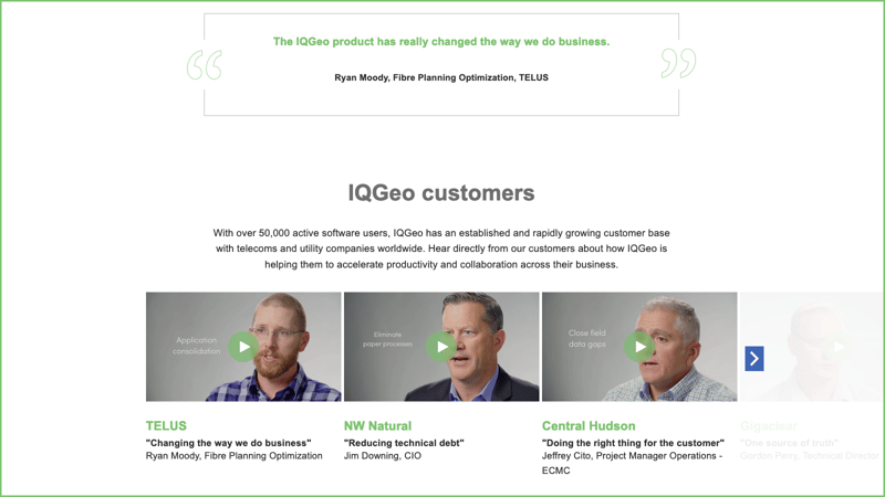
Visit the customer stories page to see how IQGeo is helping them to reimagine the role of geospatial software.

In this series of Network IQ written panel, we asked industry experts across telecom, utilities and geospatial, “What should be the single biggest innovation priority in 2022 for utility and telecom network operators?”
Read nowThe industry's most flexible and comprehensive geospatial solution to accelerate network planning, design and time to revenue from a single platform.
See it in action!


