<img alt="" src="https://secure.smart-company-365.com/266006.png" style="display:none;">
IQGeo_Logo_w_tag_2024_on_white

IQGeo Platform

A proven geospatial software platform that provides critical network situational awareness, mobility, and enhanced collaboration for telecom and utility operators.  

Share a common view of network data across all teams

Operate online or offline in the field

Improve network data quality with fast digital updates

The IQGeo Platform is an award-winning software solution that transforms the ability of telecom and utility network operators to view, update, and manage their complex and constantly evolving network assets. Integrating with existing GIS and data sources, the mobile-first Platform architecture creates an easily accessible record of your physical operations that can be securely shared across your organization to support a wide range of use cases. A single network view is easily accessible to field crews and office staff, improving situational awareness for disaster response, enhancing process collaboration, and increasing operational productivity.  

Watch the feature videos to see how the IQGeo Platform will transform your network operations.


Powerful, simple, and flexible

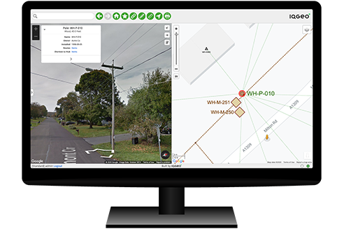
The IQGeo Platform applies the simplicity of Google Maps to enterprise processes. Its mobile-first architecture empowers field teams to create and maintain an accurate view of complex network assets.

Enterprise-scale mobility

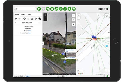
Proven enterprise-scale data sync and app updates to thousands of mobile devices without compromising performance. Field staff can run the IQGeo Platform on any iOS, Android or Windows device, online or offline.

Professional integration framework

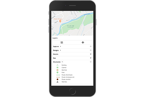
Securely connects office and field staff to simple task and role-specific views of your critical enterprise systems, supporting data feeds from millions of smart IoT network devices.

App builder and developer tools

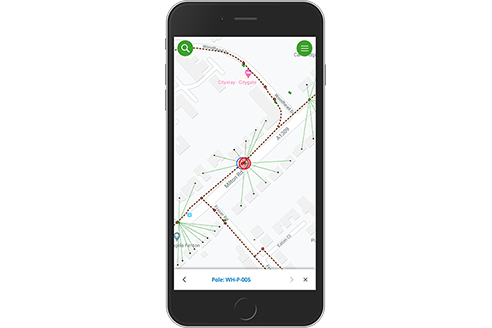
Easily set up and deploy new, specific business process applications. The development environment and APIs also give developers everything they need to build more complex, upgradable applications.

The IQGeo Platform software works in harmony with existing GIS and data sources to support office teams, mobile field crews, and contractors, providing the network insights they need to streamline construction, inspection, maintenance, and disaster response processes and dramatically improve network data quality. The architecture and capabilities of the IQGeo Platform is a game changer, allowing telecoms and utility network operators to digitize traditional manual processes and achieve a level of network visibility and productivity that is transforming businesses around the world.


Choosing the right software with IQGeo

The IQGeo Platform was designed to powerfully extend the mobile and integration capabilities of your existing GIS. If however, you’re looking for a complete network lifecycle solution, you’ll want to learn more about IQGeo’s Network Manager Telecom and Network Manager Electric software. Using intelligent network models optimized for each industry, they support the full integration of planning, design, construction, operations, sales, and disaster response processes.


myWorld is the IQGeo Platform

The 6.0 release of our software included a product name change from myWorld to the IQGeo Platform. This change reflects our focus on the IQGeo corporate brand that was launched at the beginning of 2019. Our website and latest product user interface have made the transition from the old myWorld name to IQGeo.

Relevant resources

IQGeo_Platform_6_0_release-3
play-circle

IQGeo Platform video library

book-open

Field Mobility solution for fiber, cable, electric and gas network operators  

book-open

Going beyond GIS: Managing your network through a single geospatial view

book-open

170 questions you should be asking in your mobile geospatial RFP

IQGeo customers

With over 100,000 active software users, IQGeo has an established and rapidly growing customer base with fiber, telecom and utility companies worldwide. Hear directly from our customers about how IQGeo is helping them to build better networks.

Brightspeed
"Meeting fiber deployment KPI's"

Craig Krammes, Director for IT Engineering Systems

TEPCO
"Geospatial view of damage information"

Hideaki Miyamoto, Manager - System Management Group

TELUS
"Changing the way we do business"

Ryan Moody, Fibre Planning Optimization

NW Natural
"Reducing technical debt"

Jim Downing, CIO

Central Hudson
"Doing the right thing for the customer"

Jeffrey Cito, Project Manager Operations - ECMC

Peninsula Light
"Creating the Digital Twin"

Amy Grice, Manager of System Engineering & Operational Technologies

IQGeo customer stories
"Transforming businesses"

Telecommunications and utility network operators, watch more videos

Book a Demo Case studies
Free demo

Network Manager for telecom and utilities


The industry's most flexible and comprehensive geospatial solution to accelerate network planning, design and time to revenue from a single platform.  

See it in action!