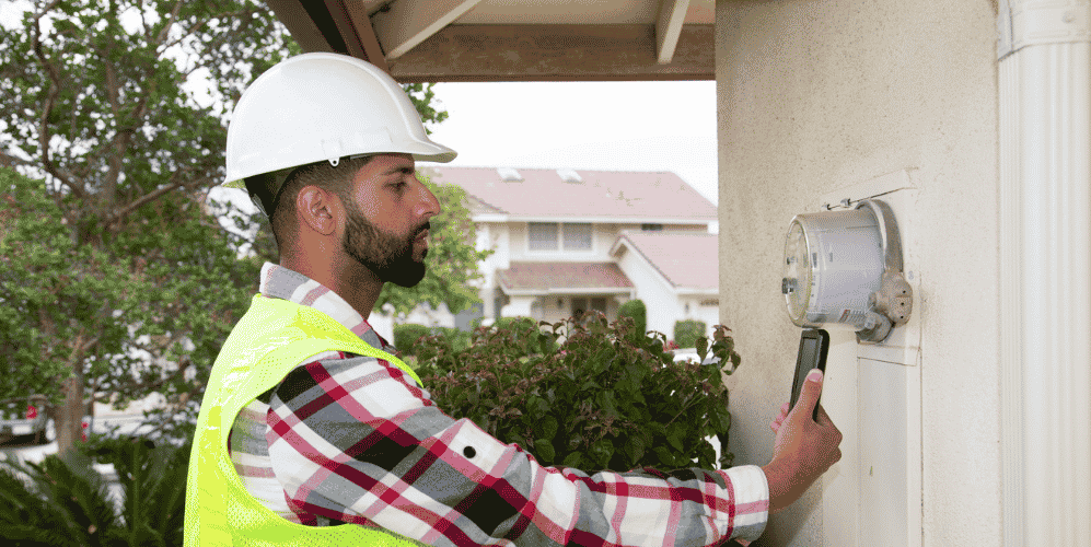
As-built documentation is one of the most critical yet persistently challenging steps in a utility’s construction process. The accuracy of network models and asset record depend on the quality of as-built data captured in the field.
However, many utilities are still burdened by outdated and fragmented as-built processes—manual redlines, disconnected applications, and incomplete geospatial data—that delay projects and introduce costly inaccuracies.
This article recaps our Bitesize Electric podcast series on as-built challenges faced by electric utilities today and outlines the best practices for overcoming them through digital transformation.
1. The burden of paper-based as-builts
Despite rapid advances in digital field tools, many utilities continue to depend on paper-based or semi-manual as-built processes. Crews often begin with a printed design or work order, mark up redlines by hand in the field, and then pass those documents to the GIS or engineering team for later digitization.
Why this matters
- Delayed updates: It can take weeks—or even months—for the back-office GIS to reflect the latest field changes.
- Data loss risk: Paper redlines can be damaged, misplaced, or misinterpreted during manual transcription.
- Reduced situational awareness: Without real-time updates, network operations and planning teams may make decisions based on outdated asset data.
![]() Best practice: Digitize redlines from the start
Best practice: Digitize redlines from the start
A digital-first as-built workflow eliminates the inefficiencies of paper-based handoffs. Field teams can complete redlines directly within a mobile application that syncs to the utility’s GIS—online or offline—ensuring immediate, accurate updates. This reduces administrative overhead, accelerates close-out times, and improves data quality across the organization.
2. Inaccurate asset locations and GIS limitations
Even when utilities capture as-builts digitally, data accuracy can still be compromised if the underlying asset locations in the GIS are incomplete or unreliable. Many network models were originally created using CAD files, legacy paper maps, or field surveys without proper GIS validation.
Why this matters
- Field inefficiency: Crews struggle to locate assets accurately, especially when geospatial data is outdated or incomplete.
- Disconnected systems: GIS updates often lag behind construction progress, creating confusion between field and office teams.
- Network modeling issues: Complex configurations are difficult to visualize, leading to inaccurate connectivity and network trace results.
![]() Best practice: Integrate GIS with real-time field context
Best practice: Integrate GIS with real-time field context
Utilities need the ability to view and update their network model directly in the field. A solution that combines real-time GIS visualization with field workflows allows teams to edit asset locations, capture new data, and instantly synchronize updates across systems. This continuous feedback loop enhances asset accuracy and ensures that every stakeholder—from the field technician to the engineer—works from the same reliable source of truth.
3. App fatigue in the field
Another key challenge uncovered in the Bitesize Electric series is “app fatigue.” Many field technicians juggle multiple applications—one for design, another for inspection, a third for work orders, and yet another for GIS updates.
Why this matters
- Inefficient workflows: Switching between apps and devices disrupts productivity and focus.
- Training overhead: Each tool requires separate logins, interfaces, and update cycles.
- Data inconsistency: Manual data re-entry across systems increases the risk of errors.
![]() Best practice: Unify field workflows in a single application
Best practice: Unify field workflows in a single application
By consolidating key functions—design redlines, work orders, asset updates, and network visualization—into one mobile platform, utilities can dramatically simplify the user experience. When technicians can perform their tasks against the live network model in one place, it accelerates as-built capture, reduces errors, and shortens the feedback loop between the field and GIS.
4. Limited barcode and scanning tools
Modern field tools can do far more than capture coordinates or photos. Barcode and scanning technology, for example, has enormous potential to improve the speed and reliability of as-built data capture, but many utilities still lack integrated solutions for leveraging these capabilities in the field.
Why this matters
- Manual data entry errors: Without automated scanning, crews must enter asset IDs or serial numbers by hand.
- Incomplete asset verification: Inconsistent labeling makes it harder to confirm asset installation or replacement.
- Slow approval cycles: Office teams must manually cross-check records, delaying closeouts.
![]() Best practice: Empower field teams with device-based scanning
Best practice: Empower field teams with device-based scanning
Today’s smartphones and tablets already include the cameras and processing power needed to perform barcode scanning and photo capture directly within a digital as-built workflow. Utilities should standardize on mobile tools that:
- Allow barcode or photo-based asset identification
- Automatically link captured data to the correct GIS features
- Enable quick photo documentation for audit and compliance
By reducing manual input, utilities can accelerate data collection, improve accuracy, and streamline asset verification and approval processes.
5. The optimal digital as-built process
When we examine each challenge individually, the optimal as-built process is one that connects all the moving parts—field execution, data capture, and GIS synchronization—into a single, digital workflow.
Why this matters
- End-to-end visibility: When every stage of construction and documentation is digital, progress and updates are transparent across teams.
- Real-time collaboration: Field and office users can share the same view of the network model and work orders.
- Faster closeout and higher data confidence: Accurate, real-time updates reduce rework and ensure the GIS reflects the true operational network.
![]() Best practice: Adopt a fully digital, mobile-first workflow
Best practice: Adopt a fully digital, mobile-first workflow
Utilities should aim for an as-built process that:
- Begins digitally at the tailboard meeting or safety briefing.
- Allows crews to access work orders, network models, and asset data on any device, online or offline.
- Supports real-time updates from the field directly into the GIS.
- Leverages photo capture and scanning to verify completed work.
This end-to-end approach ensures that as-built data is captured once—accurately, efficiently, and in context—creating a foundation for safer operations, smarter planning, and faster project delivery.
For today’s electric utilities, adopting digital as-built processes is essential—not just a recommendation
As utilities modernize their networks to support grid resilience, electrification, and distributed energy resources, the quality of their asset data has never been more critical. Digital as-built processes are no longer optional—they’re the cornerstone of an agile, data-driven utility.
By embracing mobile-first, integrated solutions, electric utilities can eliminate paper-based inefficiencies, overcome GIS limitations, and create a single source of truth for their network data.
Utilities that take this step not only improve data integrity but also empower their field and office teams to collaborate more effectively, ensuring that the network of the future is built on accurate, timely, and trusted information.
Digital as-built capture best practice guide
If you’re struggling with an as-built backlog at your utility, download our best practice guide that outlines the processes that IQGeo has developed in partnership with major utilities to streamline the as-built process.

Are you ready to modernize your as-built process?
Get in touch to discover how IQGeo enables electric utilities to digitize workflows, enhance data accuracy, and accelerate project closeouts.

 Previous

Utilities Director, IQGeo