Bitesize Fiber: Network construction | Episode 1: Construction without the chaos
Welcome to Bitesize Fiber, the podcast where we explore the real world challenges and smart solutions shaping the future of fiber and telecom, one bite at a time.
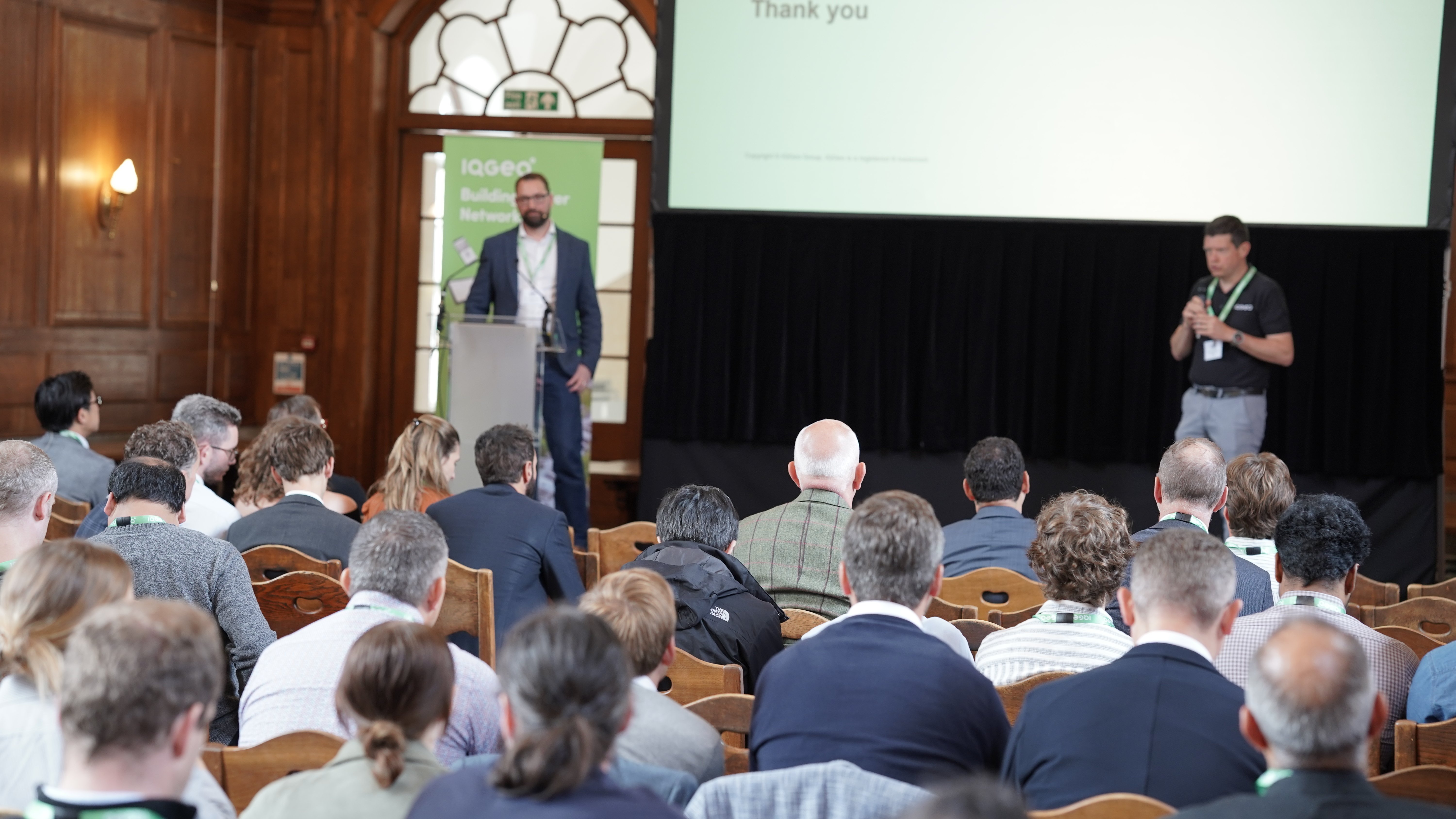
The new series of Bitesize Fiber focuses on network construction management, host Elli Puls sets the stage for a deep dive into the challenges of building fiber networks at scale. She’s joined by seasoned experts Greg Ross and Stefan Schneider, together, they explore one of the most persistent issues in fiber deployment: outdated paper designs, unpredictable last-minute changes, and the complications of disconnected permitting processes. This episode offers a candid look at why traditional approaches fall short and how the industry is beginning to rethink the entire build process.
Bitesize Fiber: Network construction | Episode 1 transcript
Ellie Puls:
Welcome to Bitesize Fiber, the podcast where we break down fiber and telecom challenges one bite at a time. I'm your host, Elli Puls, and today we're kicking off our brand new series on network construction management, where we dig into the realities of building fiber networks at scale and how operators are rethinking the way they manage the entire build process. In this series, I'm joined by Greg Ross, a construction veteran with over 35 years of boots on the ground experience. And Stefan Schneider, who brings decades of telecom knowledge from both the software and infrastructure sides of the industry. Today, we're tackling one of the most persistent issues in fiber deployment. Outdated paper prints, last minute design changes and the chaos of disconnected permitting. Let's get into it.

|

|

|
| Ellie Puls, Product Manager | Greg Ross, Customer Success Manager | Stefan Schneider, Product Manager |
Ellie Puls:
Hi, Greg and Stefan. Welcome and thank you so much for joining. So we are talking today about the build and construction process. Greg, I'd love to hear a little bit about your background if you will share.
Greg Ross:
Yeah, sure. Hey, Ellie. Hey, Stefan I've come to IQGeo from a very large contractor in the United States doing telecommunications for over thirty-five years. I have a strong background in cable TV design, telecommunication, fiber design permitting, extensive permitting, and a vast amount of experience doing construction work and a little bit of operations as well.
Ellie Puls:
So, Greg, in that case, you've been in the trenches, literally, I know probably you've worked on aerial strands, underground trenching, splicing, activation. Can you tell us a little bit about what that was like and any kind of issues you ran into in the field?
Greg Ross:
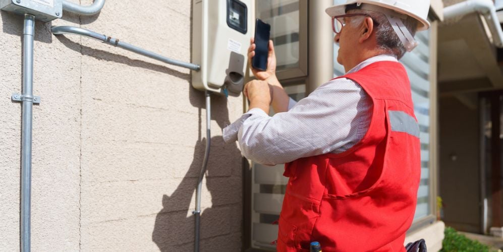
Yeah, sure. The main thing about being prepared when you're in the field, when you're doing your construction, when you're at your construction phase is the ability to have the most current construction prints that you receive from your engineering firm. To have all your approved permits in line when you get out in the field so that if a municipality pulls up to you and ask you for a permit for your right of way permit or your utility easement permit, then you're going to have them on hand. And then it's not going to, you know, impede any of your construction that you're going to plan on doing that day.
One of the main things that I've come across in my career is the ability, or lack of ability in the early years is to get updated prints. As everybody knows, there's a, you know, there could be day-to-day design changes based on permitting, based on what side of the road you're going to go on, based on if you, if you have to go from underground to aerial or vice versa from aerial to underground. There's just a lot of variables that come into play and it's very important to have the updated construction drawings that pertain to the particular phase or the area in which you're going to construct in that day. It's been my experience that in the new age that we have with the introduction of GIS capabilities instead of having everything in a CAD format.
To have the data like IQGeo has in their Network Manager to have the most current design right on a an iPad or your, or your phone. And the ability to have the uploaded permits to that particular area in which you're going to construct that day or that week or that month, that's really a real benefit, for some of the challenges that I face in my career from having the most accurate drawings in the field to complete the construction, for that day or that week.
Ellie Puls:
Are there a lot of teams that still use paper-based prints? Or how has that changed to digital going?
Greg Ross:
Believe it or not, there's still a lot of telco companies that use hand PDFs. They create them in a CAD format, they print them out, and typically it's a, it's an 11 by 17 drawing. And it outlines to the construction teams where you're going to be placing your conduit, where you're going to be placing your fiber. Where your splice points are going to be, where all your structures are going to be placed and your splicing locations, your terminals, your in a centralized architecture, your cabinets, or in a distributive one, your points of connection in the field. Recently I had a customer that was able to get away from doing the paper drawings.
We actually use the software Network Manager to actually access the, the build design in an iPad or a phone and we were able to actually construct it right out of that. Therefore, we alleviated the need for outdated prints, the construction prints, the 11 by 17s that I referred to and really more important than that, we were able to upload the approved permits for that particular permitting agency, city, or the Department of Transportation street, whichever road we were on. And that's really critical because you have to have your construction drawing and your permits.
They go hand in hand because if you get stopped by an agency, you'd get shut down. You could have you know, a lot of fiber in the ground. If you get shut down, you could be having dangerous situations where you might have road crossings that you got to get done real quick and that's the last thing you want to do is get shut down when you're pulling a long string of fiber across any kind of roadway or anything like that.
Stefan Schneider:
Yeah, that's very true. It's the reason why it's best practice to make sure that people in the field have the most up-to-date information. You cannot do that with printed maps. You cannot do that with CAD designs that have been exported to PDF or printed in a large format plotter. The only way that you can have crews in the field have the most accurate information at their fingertips is by having these applications running on the mobile device of their choice so they can actually access that data, and be much more efficient.
Stay tuned for the next episode in our network construction series: Permitting without the paper chase. Meanwhile, catch up on the Bitesize Fiber network operations series.