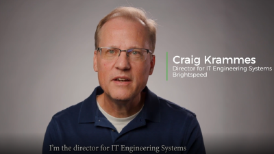
Brightspeed
"Meeting fiber deployment KPI's"
Craig Krammes, Director for IT Engineering Systems
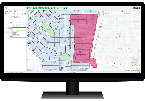
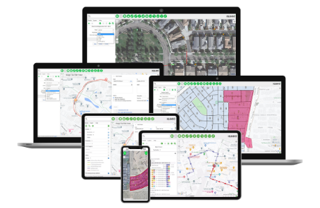
Flexibly model any network asset with an accurate digital twin

Accelerate digital transformation for every workflow
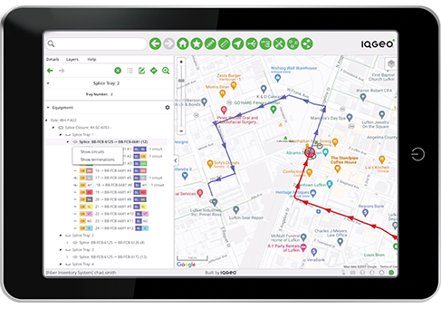
Improve data accuracy, from the office to the field
As telecom network operators work to deliver modern fiber broadband networks, you face increasingly complex and dense systems. Rolling out a modern fiber network demands speed and agility, something traditional Geographic Information Systems (GIS) simply can’t deliver.
IQGeo Network Manager TelecomTM is a game-changing network model management solution that is optimized for telecom network operators and the new challenges you face, from growing complexity to expansion into rural communities. Network Manager Telecom provides the industry’s most agile and open fiber optic network management software, accelerating planning and design while supporting the entire network lifecycle through construction and maintenance operations.
We offer Network Manager Telecom in three editions to meet the needs of any operator, regardless of size or complexity. Visit our editions overview page to find out which edition is right for you.


Network Manager Telecom is the industry’s leading network management software for everyone from small private networks to national telecom operators, offering the flexibility to meet the size and complexity of any network.
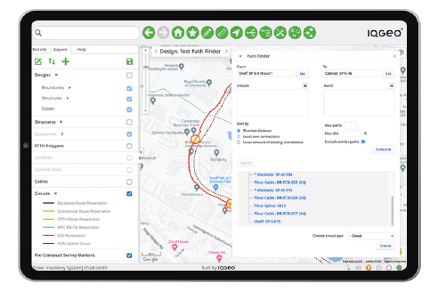
With a fully integrated architecture, Network Manager Telecom connects end-to-end workflows and applications to streamline and optimize every network process.
Our rapidly deployable solution and easy-to-use interface empower every team to execute work according to leading industry standards – without changing your network model.
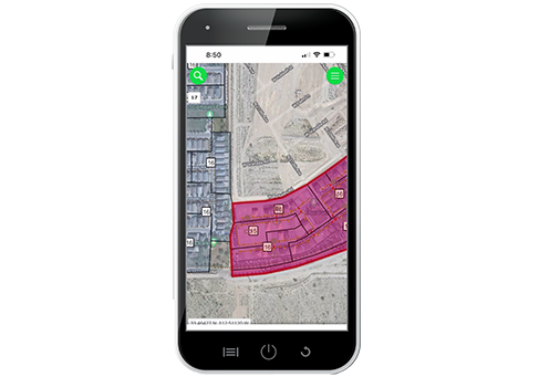
Network Manager Telecom enables field teams to document and manage data online or offline, more powerfully and flexibly than other solutions, ensuring accurate, up-to-date data.
As your network architecture, IT systems, and number of users and business objectives evolve, our scalable solution can model future network architectures, operational requirements, business needs, and data sources to continuously enhance your network.

Network Manager Telecom product sheet
Fiber operators can start fast and easily scale up with new IQGeo software editions
Watch the feature videos to see Network Manager Telecom in action
Streamlining broadband operations through the power of integration
Craig Krammes, Director for IT Engineering Systems

Hideaki Miyamoto, Manager - System Management Group

Ryan Moody, Fibre Planning Optimization

Jim Downing, CIO

Jeffrey Cito, Project Manager Operations - ECMC

Amy Grice, Manager of System Engineering & Operational Technologies
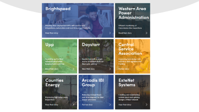
Telecommunications and utility network operators, watch more videos
Insight | Professional | Enterprise
When you choose Network Manager Telecom, you can support your entire network lifecycle, leverage best-in-class mobility, and easily adapt for future expansions and requirements.
Discover which edition is the perfect fit for you!
Find out more
